How Wind and Rain Monitoring Supports Smart Urban Drainage?
Rain nourishes urban green spaces, while gentle winds improve ventilation and thermal comfort. Understanding these everyday benefits is the first step toward making better use of wind and rain in cities. For smart city planners, continuous monitoring of rainfall, wind speed, and wind direction provides valuable local data. This data can then support rainwater use, public space assessments, and risk analysis as weather conditions change.
Cities Need Wind and Rain—and Must Adapt to Their Changes
Wind and rain are part of daily city life. They also bring measurable benefits. Rain nourishes green spaces and can become a source of water. Singapore uses about two-thirds of its land as water catchment, directing rainwater into 17 reservoirs before treating it for homes and businesses. Trees help keep rainwater out of drainage pipes during a storm. Based on New York City’s 2007 tree data, an estimated 590,000 street trees intercept about 3.37 million cubic meters of rainwater each year. Their annual stormwater management benefit was valued at approximately US$35.63 million. Moderate winds can help cool streets and influence air quality. During 42 lake-breeze events recorded in Chicago in 2022, weekday breezes were associated with average ozone reductions of up to 6 ppb along the city’s northeastern shoreline.
These benefits have limits. In April 2024, heavy rain flooded roads around Dubai’s airports, making it difficult for passengers and crews to reach them. The disruption led to 2,155 flight cancellations and 115 diversions. Emirates said the event cost the airline about US$110 million. In September of the same year, Typhoon Yagi affected Haikou. Haikou Meilan International Airport cancelled 204 flights on September 6 alone. Cranes, walls and scaffolding collapsed at some construction sites, and preliminary losses to building and municipal projects reached CNY 1.92 billion. Cities need to track rainfall, wind speed and wind direction as conditions change. That information helps them use rainwater, manage drainage and act before strong winds cause damage.
How Do Strong Winds and Heavy Rain Affect Urban Transport and the Economy?
The damage from a downpour does not end when water drains from the streets. During one extreme rainstorm, floodwater breached a subway flood barrier and rushed into a rail tunnel, trapping a train. In a separate road tunnel, more than a hundred vehicles were submerged. Even after the water receded, underground facilities and vehicles needed cleaning and repairs, while disrupted transport affected commuters and deliveries. The disaster caused tens of billions of yuan in direct economic losses across the city.
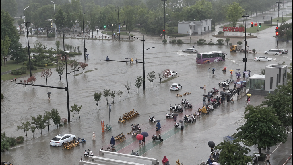
In 2024, flooding, landslides and high winds from Hurricane Helene severely damaged western North Carolina in the United States. About 9,400 road sections and 846 public bridges were damaged. Part of Interstate 40 was washed away and remained fully closed for about five months. The state transportation department estimated US$5 billion in road and bridge repair costs. The state also estimated more than US$12.4 billion in losses from reduced business revenue. The impact of disrupted roads extended well beyond the cost of repairing them.
How Wind Speed and Direction Affect Waterlogging on City Roads
Wind can shift where rain falls, but road elevation and drainage capacity largely determine where water collects. In a street-level simulation, upwind areas received 5%–17.4% more rain under specific conditions. Study In coastal cities, onshore winds can also raise sea levels and slow drainage. During Hurricane Sandy, floodwater reached 3.4 m and 4.3 m above ground in two New York City areas. This was coastal flooding driven by several factors, not ordinary rainwater ponding. NYC report
Understanding these risks begins with observing how local weather changes. Drainage teams need timely rainfall data and local wind measurements, alongside water-level and drainage-system data, to assess conditions around roads and drainage facilities.
Why Cities Need On-Site Wind and Rain Data
Urban roads and drainage facilities face more than the effects of total rainfall. How quickly rain intensifies also matters. Impervious surfaces turn rain into runoff quickly. As a result, small urban catchments need timely rain-intensity data. Research on urban rainfall shows that coarser time resolution can weaken runoff analysis in small drainage areas.
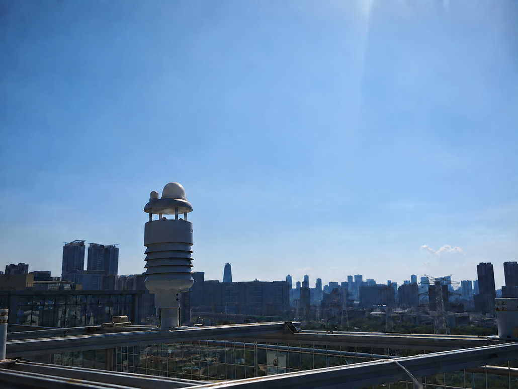
To help teams monitor conditions near the places they manage, we provide professional weather monitoring equipment. The SenseCAP S700-A and S700-C use radar to measure rain intensity. They also use ultrasound to measure wind speed and direction. Both sets of readings come from the same location.
Tracking Rainfall Intensity with Radar
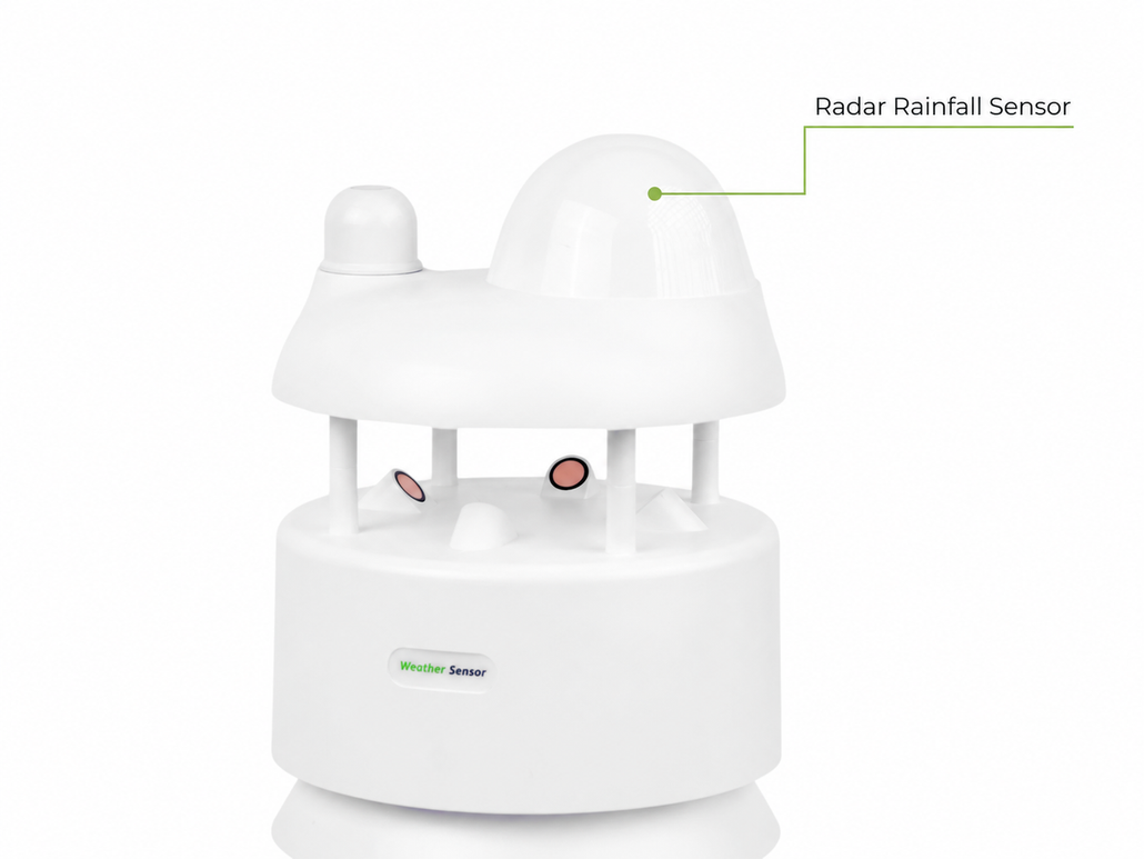
Radar rainfall sensing estimates rain intensity from signals reflected by falling drops. It helps teams see when rain grows heavier or begins to ease. They can then compare those changes with nearby water-level readings. SenseCAP’s non-contact radar design needs no collection funnel or moving rain-gauge parts. This reduces the risk of funnel blockages and mechanical wear. It can also ease routine maintenance at outdoor monitoring sites.
Measuring Wind Speed and Direction with Ultrasound
Our weather station series uses ultrasonic technology to measure wind speed and direction. The sensors send sound pulses in different directions and compare their travel times. Sound travels faster downwind and slower upwind. The station uses these time differences to calculate wind speed and direction. There is no need to wait for cups to start spinning or a vane to turn. This helps detect lighter winds and respond more quickly to changing wind conditions.
With no rotating parts, mechanical friction, wear, and the risk of jamming are reduced. This also lowers the need to repair or replace moving components. The World Meteorological Organization’s observation guide notes that these sensors offer good durability and little deterioration in measurement accuracy over time. For weather stations deployed outdoors over long periods, this helps reduce maintenance needs.
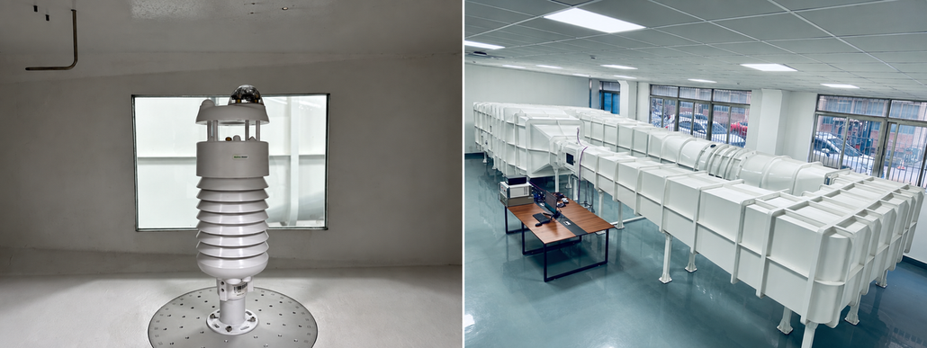
To support accurate wind measurements, Seeed Studio also operates its own wind tunnel laboratory. Its precision calibration system supports 360° wind direction control and wind speeds from 0.1 to 80 m/s. Every weather sensor is tested and calibrated under controlled wind conditions before delivery. By comparing sensor readings with known wind conditions, we can check measurement accuracy and verify the consistency of wind speed and direction readings.
Together, wind and rainfall readings give teams a clearer picture of local weather during rain. Teams can then combine these readings with water level and drainage system data. This information supports road inspections, facility management, and risk assessments.
About Author
