Meshtastic Map: How to View, Use, and Add Maps to Your Device
Meshtastic is designed for off-grid messaging, but location data becomes far more useful when you can see it in visualization. Meshtastic maps turn node position data into a clear geographic view, helping users understand where devices are located and how a mesh is distributed across an area.
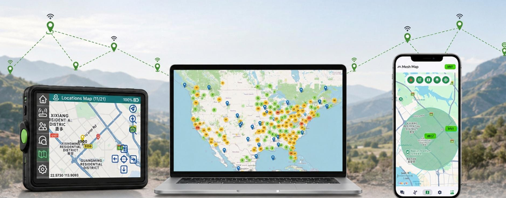
In this guide, you will find answers to these questions:
- What is a Meshtastic map, and what information can it display?
- How do web, phone, and on-device Meshtastic maps work?
- What role does MQTT play in a Meshtastic map?
- How to use offline maps on your Meshtastic device (using the Wio Tracker L2 Pro as an example)?
What Is Meshtastic Map?
A Meshtastic map shows Meshtastic nodes and their locations on a geographic basemap. It converts position packets into an easy-to-read network view, so users can quickly understand where nodes are located and how they are distributed across an area.
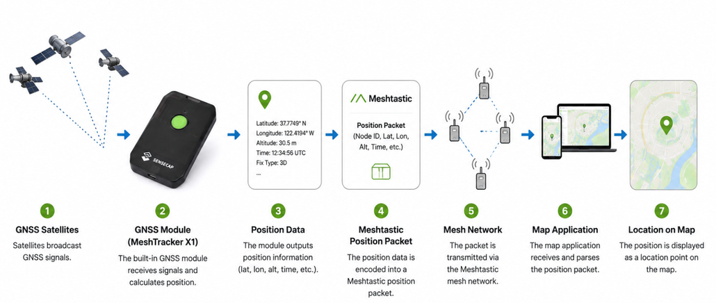
This Position visualization is useful for hiking, team coordination, asset tracking, remote monitoring, and network planning. It can help users locate team members, identify useful relay positions, and make better decisions about where to place Meshtastic devices.
What Can You See on a Meshtastic Map?
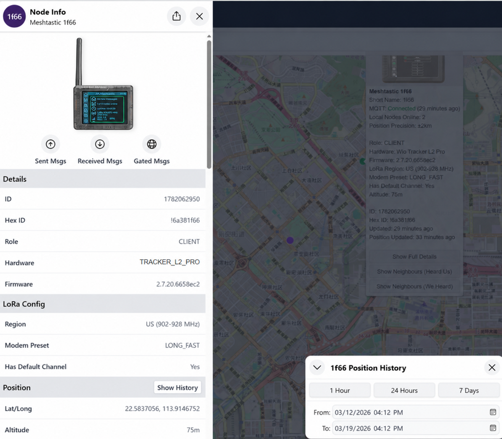
Most Meshtastic maps show each node’s location, long and short name, node ID, and last update time.
Depending on the map and the data available, you may also see altitude, hardware model, battery level, device role, firmware version, signal information, routes, position history, neighbor links, or waypoints.
Different Types of Meshtastic Map
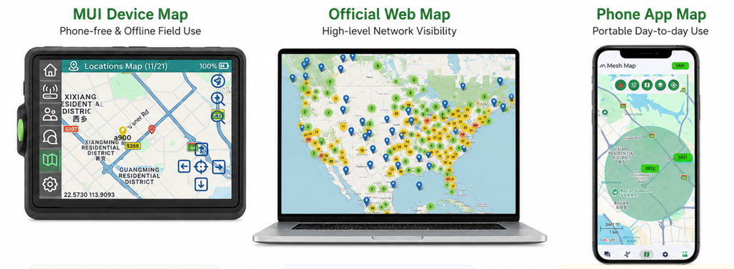
The easiest way to choose a Meshtastic map is by where you want to view it and where its node data comes from.
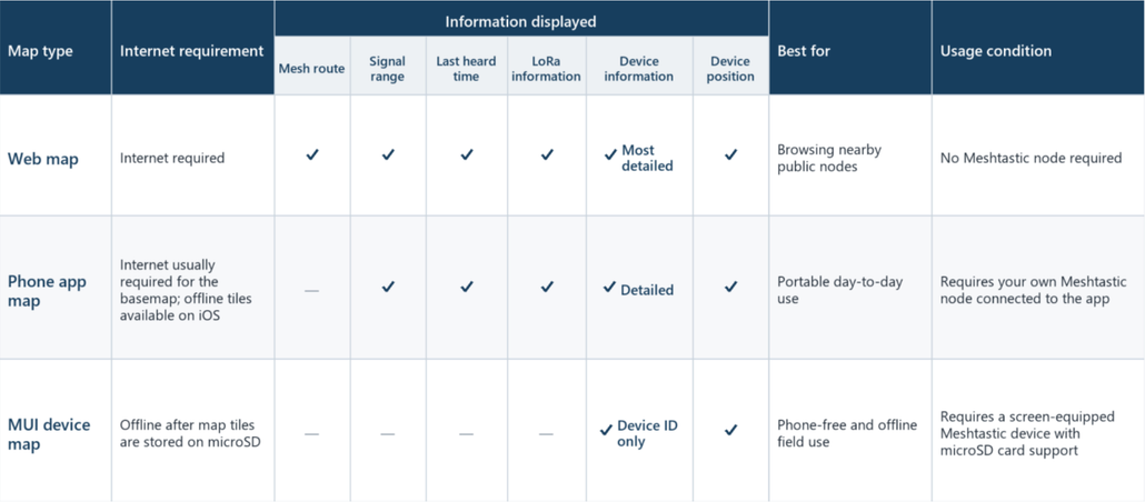
Meshtastic Map on website
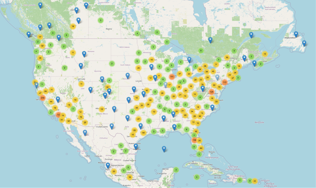
The official Meshtastic project provides a browser-based map at map.meshtastic.org. It visualizes public gateway activity and offers a quick way to see where internet-connected Meshtastic infrastructure is reporting. It does not represent every LoRa-only node in an area. Meshtastic devices periodically report their location to a Meshtastic server via MQTT.
For more detailed node-level exploration, Liam Cottle’s Meshtastic Map shows nodes heard through MQTT and adds tools such as search, telemetry graphs, traceroutes, position history, and neighbor overlays. It is a community-run service rather than an official Meshtastic project map.
| Web map | Key features | Best for | Important notes |
| Official Meshtastic Map | Public gateway locations, point view, and density heatmap | A quick global view of gateway activity | Official project map; it does not show every LoRa-only node |
| Liam Cottle’s Meshtastic Map | Node search, telemetry graphs, traceroutes, position history, and neighbor links | Deeper node-level exploration and analysis | Community-run service with its own MQTT uplink endpoint |
Other Meshtastic communities operate regional maps that focus on the nodes and activity most relevant to their area. Search for a Meshtastic group in your region and use the map and MQTT settings it recommends, because community services may have their own brokers, filters, and participation rules.
| Community map | Region |
| NoDak Mesh Map | North Dakota, USA |
| MeshView Meshtastic España | Spain |
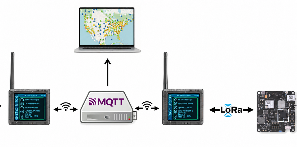
The Node Map retrieves these reports and displays each node’s position, route, and signal range. Devices can report their location:
- Directly via MapReport: The device sends location data to the server directly.
- Indirectly via other nodes: The location is relayed through neighboring nodes.
Learn how to get started with Meshtastic Node Map here.
Meshtastic Map on the phone
The Meshtastic app on mobile phone is usually the most convenient map for everyday use. Your Meshtastic radio sends its NodeDB and newly received position packets to the app over Bluetooth, USB, or a network connection. The app draws those node positions over a basemap. If MQTT is enabled, the phone may also proxy MQTT traffic and expand what the connected radio can receive beyond the local RF mesh.
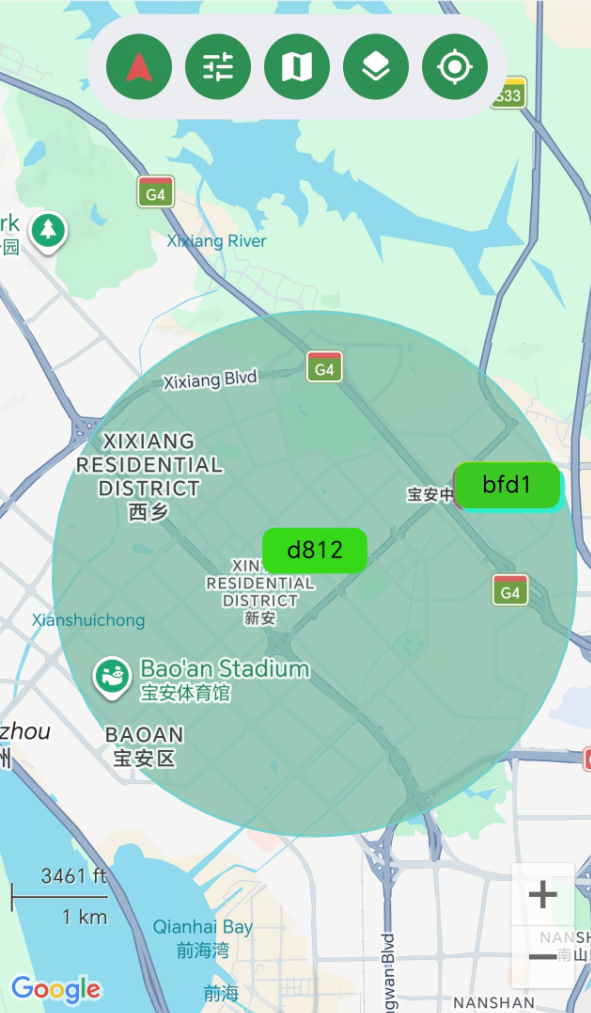
An Internet connection is normally needed to load the basemap. The official IOS client supports offline map tiles. Learn how to get started with Meshtastic Phone Map here.
Meshtastic Map on the device
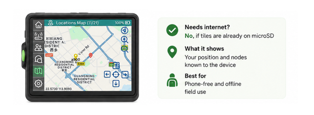
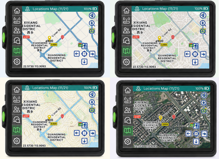
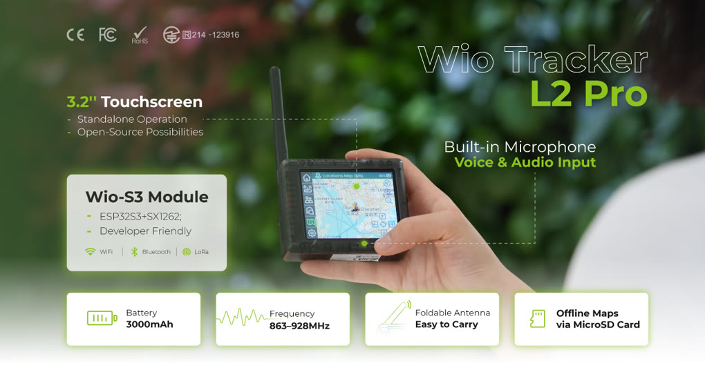
Meshtastic UI (MUI) is an open-source graphical interface for devices with display. The map panel can load tiles from microSD. The map can be interacted with by panning and zooming. Once the required tiles are on the card, the map background no longer depends on a phone or internet connection. Learn more about MUI here.
How to Add a Map to Your Meshtastic Device
A web map answers “what is publicly reporting online?”, an on-device map answers “what does this radio know here and now?”. For hiking, camping, events, disaster preparation, and remote site work, the second question is often more useful. Offline tiles make the map independent of cellular coverage, reduce phone dependence, and keep the map available even when an online service is unreachable.
Why Use a Map on Your Meshtastic Device?
- One-device mobility: carry the radio, map, and position display together.
- Offline resilience: stored tiles remain available without Wi-Fi or mobile data.
- Faster field checks: glance at nearby known nodes without unlocking and pairing a phone.
- Lower dependency risk: the local display does not depend on an MQTT broker or public map uptime.
- Controlled preparation: load only the regions and zoom levels you need to balance detail and storage.
What You Need to Prepare
- A Meshtastic device with a screen and microSD card support, such as (Wio Tracker L2 Pro)
- microSD card (Capacity: 8 GB–32 GB, File system: FAT32)
- Computer
- microSD card reade
Before starting, update the Wio Tracker L2 Pro to a compatible Meshtastic firmware build and confirm that MUI detects the microSD card.
Add Maps to Wio Tracker L2 Pro
Step 1. Format the microSD Card
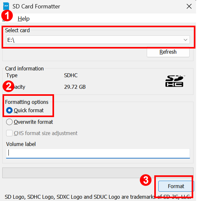
Download and install the SD Memory Card Formatter from the SD Association. Insert the card into the reader, select the correct drive, choose Quick Format, and start formatting.
The card is now ready for storing offline maps.
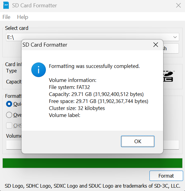
Please note formatting deletes all files on the card, so back up any important data first.
Step2. Create the Directory Structure
For MUI to recognize your maps, they must be placed in a specific folder hierarchy on the root of your SD card:
- Create a folder named maps (lowercase).
- Inside maps, create a subfolder for the style, such as CartoDark.
- The final path should look like: SD_ROOT/maps/CartoDark/
Step3. Download the Offline Map
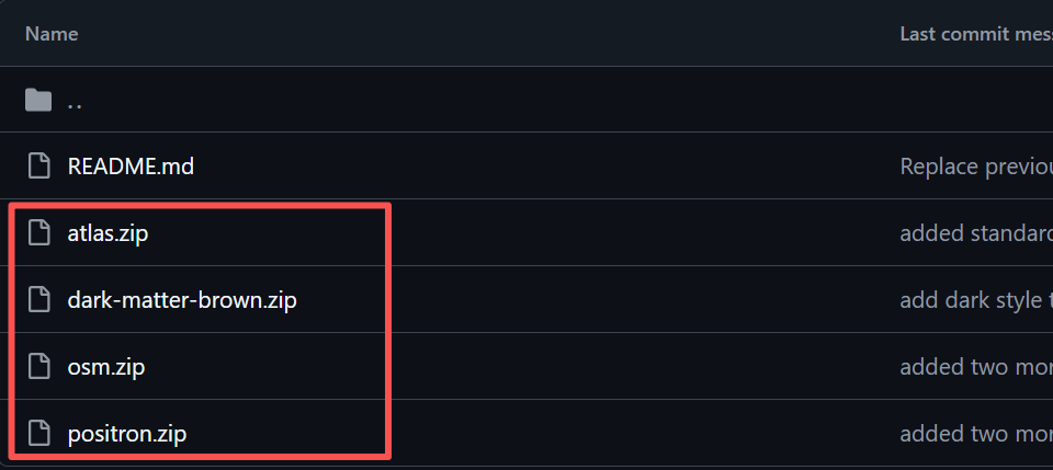
Open the official Meshtastic device-ui map starter kit and download one or more map styles, such as atlas, dark-matter-brown, osm, or positron. You can choose one or more of your favorites to download.
Step 4. Copy the Map Files
- Open the microSD card.
- Extract the downloaded ZIP package into the maps folder
The directory should look like this:
microSD
└── maps
    ├── atlas
        └── 0
        └── ...
        └── 8
    ├── dark-matter-brown
    └── osm
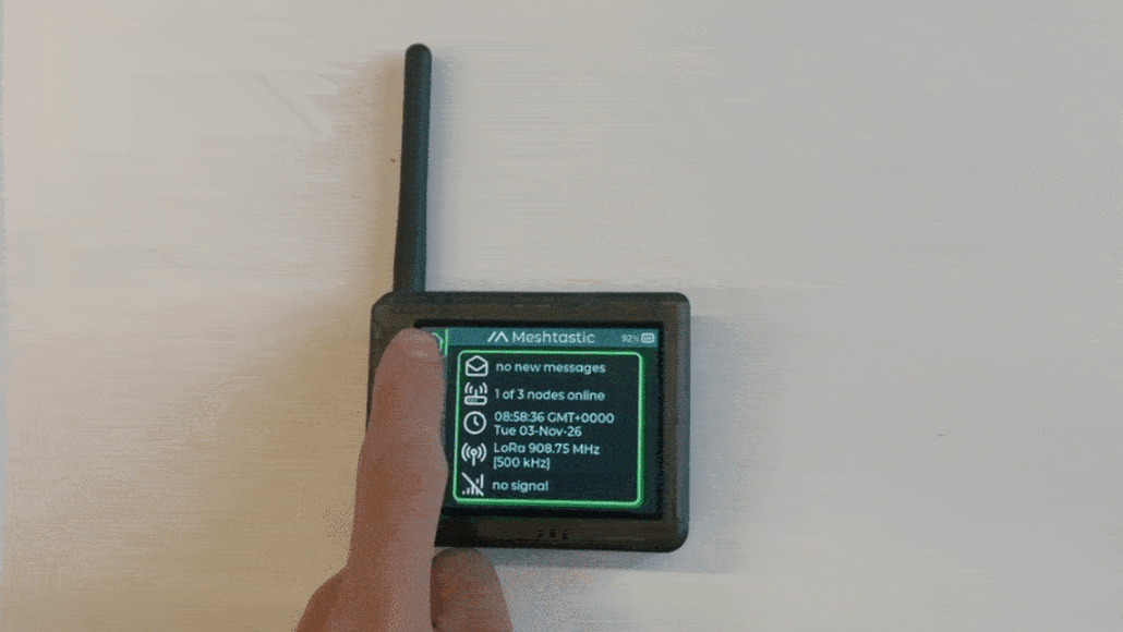
Safely eject the microSD card after the copy process is complete. Then you can insert the card to L2 and check the map.
Step 5. View the Map
Wait for the device to obtain a GNSS fix or set a valid fixed position
Open Map. Your own position should center the view; other markers appear when the device has usable position data for those nodes.
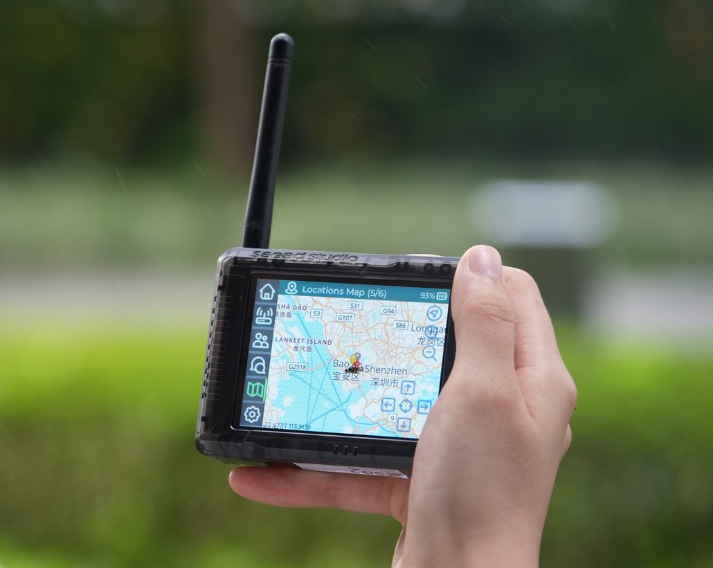
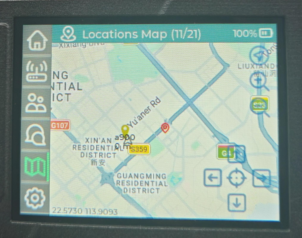
Offline tiles provide the map background. Node positions still come from the device’s GNSS data and the Meshtastic nodes it receives over LoRa or an intentionally configured MQTT connection.
Troubleshooting Meshtastic Map Issues
Why Is My Node Not Showing on the Map?
- The node has no GPS fix yet. GPS signal detection needs a clear view of the sky to get its first position fix. A cold start can take anywhere from 30 seconds to several minutes.
- Position broadcasting is disabled or set too infrequently
- Privacy settings reduce precision. Meshtastic allows you to reduce the precision of shared location for privacy. If this is enabled, your node may appear in a rounded-off position or, in some map views, not at all.
Why Is My Location Not Updating?
- Weak or lost GPS signal. GPS requires line-of-sight to satellites. In dense forest, narrow canyons, urban canyons, or indoors, the GPS module may lose its fix and stop producing new coordinates. Move to an area with a clearer view of the sky and wait for the fix to return.
- Smart Distance limits updates. Meshtastic has a “Smart Distance” feature that reduces position broadcast frequency when the node is stationary or moving slowly. If you’re not moving much, the node intentionally sends fewer position updates to save power.
- Power-saving mode is throttling GPS. Some devices enter a low-power state that polls the GPS less frequently. If you need real-time tracking, check your power management settings and consider increasing the GPS update rate at the cost of battery life.
- Firmware or hardware issue. If none of the above applies, there may be a firmware bug or a GPS module/antenna problem. Try updating to the latest firmware, and if the issue persists, check whether the GPS module is reporting any data at all in the device debug logs.
Why can’t we see the other nodes?
- Out of radio range. Meshtastic uses LoRa radio, which has a finite effective range depending on terrain, antenna type, and transmit power. If other nodes are too far away, or if hills, buildings, dense foliage, or other obstacles block the line of sight, your device won’t receive their broadcasts and they won’t appear on the map.
- Different channel or frequency settings. Nodes can only communicate when they share the same channel. If your node is set to a different channel than the nodes you’re trying to see, you will never pick up their transmissions, even if they are physically nearby. Double-check that all devices use the same primary channel settings.
- Mismatched encryption key (PSK). Meshtastic channels can be encrypted with a pre-shared key (PSK). If two nodes are on the same channel but use different PSKs, they will receive each other’s radio packets but cannot decrypt them, so the nodes and their positions will not show up in your node list or on the map.
- Other nodes are not broadcasting their position. A node only appears on the map when it actively sends position updates. If the remote node has position broadcasting disabled, has set its location share mode to “off,” or is in a privacy mode that withholds exact coordinates, you may see the node in your node list but not on the map, or you may not see it at all.
- Nodes haven’t been discovered yet. When a node first powers on, it takes time to discover and learn about other nodes on the network. Position updates are broadcast at intervals (often every few minutes), and the node database builds up gradually. If you just turned on your device, wait at least 5–10 minutes in an area with known node activity before concluding that no other nodes are present.
- Regional frequency band mismatch. LoRa operates on different frequency bands in different countries (e.g., US915, EU868, CN470). If a node is configured with the wrong region setting, it will transmit and listen on frequencies that are illegal or unused in your area, making it impossible to communicate with local nodes. Verify that every node’s region setting matches the country it is being used in.
Read More <<
About Author
