How SenseCAP All-in-One Compact Weather Stations Enable Smarter Road Weather Monitoring and Safer Roads
Introduction
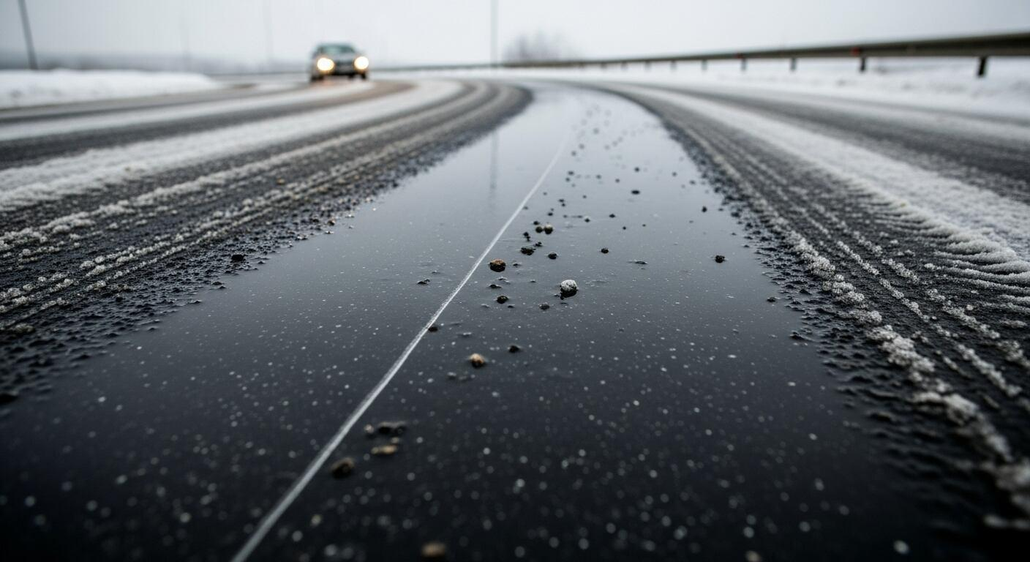
Road safety depends on more than road design and traffic management. Weather conditions can change rapidly, turning an otherwise safe road into a potential hazard. Black ice may form overnight, strong crosswinds can affect vehicle stability on exposed bridges, extreme heat can contribute to asphalt deformation, and heavy rainfall can increase the risks of flooding and reduced visibility.
For road operators, the challenge is not simply knowing what the weather will be like. It is understanding how changing weather conditions affect specific road sections and having enough time to respond before conditions become dangerous.
Traditional road inspections and regional weather forecasts remain valuable, but they may not provide the continuous, site-specific information needed to identify rapidly developing risks. This is where road weather monitoring becomes important. By collecting real-time environmental data, road operators can better understand local conditions, identify potential hazards, and make more informed decisions about inspections, maintenance, and traffic safety measures.
In this article, we explore four common weather-related road safety challenges and explain how weather monitoring can support risk assessment, improve road management, and help build safer, more resilient transportation networks.
Why Weather Conditions Are a Critical Factor in Road Safety
Weather affects road safety in different ways, and its impact often depends on the location, season, and surrounding environment. A sudden temperature drop can create icy patches, strong winds can destabilize vehicles on elevated roads, prolonged heat can place additional stress on asphalt, and intense rainfall can overwhelm drainage systems.
These risks are not always immediately visible. A road may appear safe while environmental conditions are already becoming unfavorable. For example, a bridge deck may cool faster than the surrounding ground, or a localized rainstorm may produce intense rainfall over a short stretch of highway while nearby areas remain relatively dry.
For road operators, identifying these changing conditions early is essential to prioritizing inspections, planning maintenance, and determining when additional safety measures may be necessary.
1. When Changing Weather Creates Unexpected Road Hazards
Different weather conditions create different challenges for road infrastructure and traffic management:
- Road icing: Falling temperatures, moisture, and surface cooling can create conditions favorable to frost or ice formation, particularly on bridges, shaded roads, and exposed mountain routes.
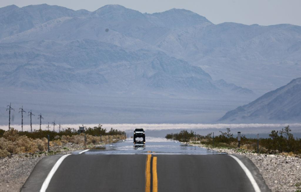
- Asphalt heat stress: High air temperatures and strong solar radiation increase the heat load on road surfaces, potentially contributing to asphalt softening and deformation under suitable material and traffic conditions.
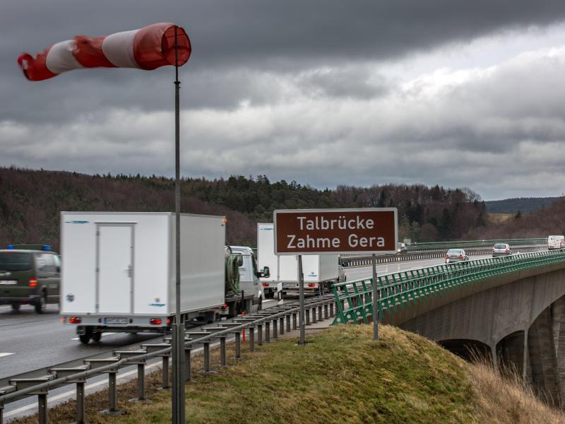
- Crosswinds: Strong lateral winds can affect vehicle stability, especially for trucks, buses, and other vehicles with large exposed side areas traveling across bridges or open highways.
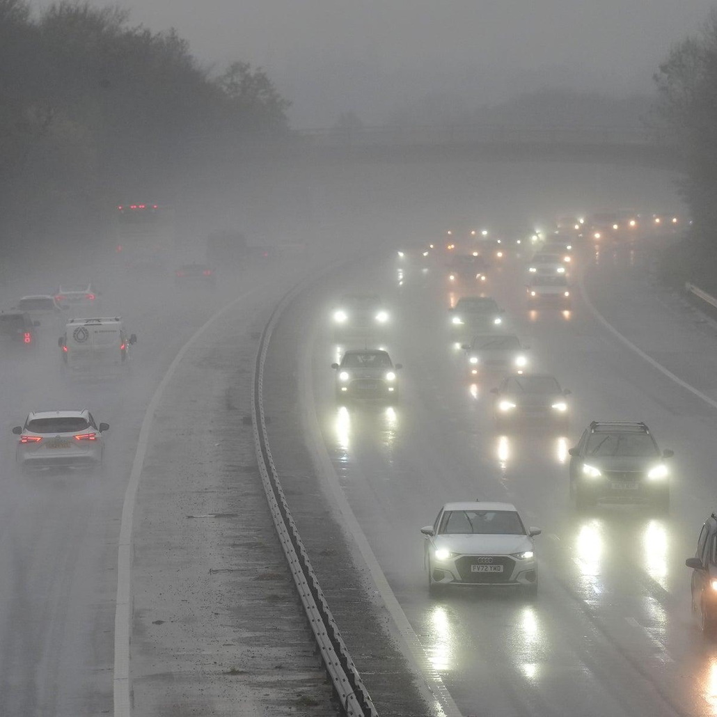
- Heavy rainfall and reduced visibility: Intense rainfall can increase surface water accumulation and drainage pressure, while rain, fog, and spray can make it harder for drivers to see the road ahead.
Although these hazards differ, they share a common characteristic: local environmental conditions can change faster than periodic inspections can reliably capture. By the time a problem is reported by a driver or discovered during a routine patrol, the road may already present a safety risk.
Continuous weather monitoring helps bridge this information gap by providing ongoing measurements of environmental conditions at selected locations. These measurements do not replace direct road-surface inspections or specialized sensors, but they provide valuable context for understanding how risks develop.
2. When Traditional Road Monitoring Is No Longer Enough
Road operators have traditionally relied on routine inspections, weather forecasts, and reports from drivers to keep roads safe. These methods remain useful, but they do not always provide a complete picture of changing road conditions.
Weather forecasts help predict what may happen, while inspections reveal what is happening at a particular moment. However, conditions can change quickly between inspections, and weather can vary from one road section to another. A bridge may become icy while nearby roads remain clear, or a sudden downpour may affect only part of a highway.
This makes it difficult to identify every potential hazard in time using traditional methods alone. By continuously collecting local weather data, road operators can better understand changing conditions and take a more proactive approach to road safety.
How Weather Monitoring Helps Address Common Road Safety Challenges
Different weather conditions create different risks for roads and the people who use them. From icy surfaces in winter to heat stress in summer, understanding local weather changes can help road operators identify potential hazards and plan appropriate responses.
By continuously monitoring key environmental parameters, road weather monitoring systems provide useful insights into changing conditions across different road sections. The following four scenarios illustrate how weather data can support safer and more proactive road management.
1. Detecting Road Icing Risks with Weather Data
Road icing is a major concern during winter, particularly on bridges, shaded roads, and mountain routes where temperatures can drop quickly. Even when most roads remain clear, certain sections may develop frost or ice, creating slippery conditions for drivers.
Air temperature alone cannot reliably determine whether a road surface is icy. Road operators also need to understand moisture conditions and how the surrounding environment affects surface cooling.
Monitoring air temperature, relative humidity, and dew point can help identify conditions favorable to frost formation. Rainfall measurements can provide additional context when roads are wet before temperatures fall, while solar radiation data can help explain how road surfaces warm during the day and cool after sunset.
By tracking these parameters over time, road operators can identify periods when icing risks may increase and prioritize inspections of vulnerable sections. This information can also support decisions about when to prepare de-icing materials or issue weather-related road warnings.
However, weather data alone cannot confirm the presence of ice. For direct assessment, road-surface temperature sensors or dedicated road-condition monitoring devices may be needed alongside weather stations.
2. Monitoring Heat Stress on Asphalt Roads
During prolonged heatwaves, high temperatures can place additional stress on asphalt roads. When combined with heavy traffic and the characteristics of the pavement material, excessive heat may contribute to asphalt softening, rutting, and surface deformation.
Understanding these risks requires more than checking the daily maximum air temperature. Solar radiation, wind conditions, and local exposure all influence how much heat a road surface absorbs and releases.
Air temperature and solar radiation measurements can help road operators understand changing thermal conditions, while wind data provides further context for how the surrounding environment affects heat exchange. Tracking these parameters over time can help identify periods of elevated heat exposure and support maintenance planning.
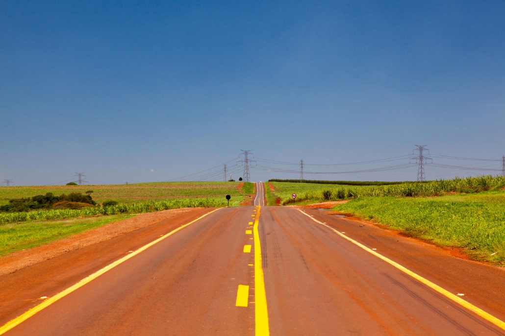
For example, road maintenance teams may use weather trends to schedule inspections during prolonged hot spells or prioritize sections that are already prone to deformation.
It is important to distinguish environmental monitoring from direct pavement assessment. To determine whether asphalt is approaching a critical temperature, road-surface temperature measurements and information about pavement materials and traffic loads are also important.
3. Identifying Crosswind Hazards on Highways
Strong crosswinds can create dangerous driving conditions, especially on bridges, elevated roads, coastal highways, and other exposed sections. Large vehicles such as trucks and buses may be particularly vulnerable because their broad side surfaces can catch strong lateral winds.
Regional forecasts can indicate that windy conditions are expected, but wind conditions may vary considerably along a highway. Local measurements help road operators understand what is happening at the locations where wind exposure is a concern.
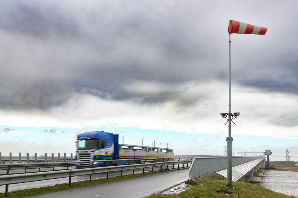
Wind speed and wind direction are the key parameters for assessing crosswind conditions. When interpreted alongside the orientation of the road, these measurements help operators understand whether the wind is blowing across the roadway and whether its strength is increasing.
Continuous monitoring can support site-specific warning thresholds and provide information for decisions such as displaying wind warnings, adjusting speed limits, or implementing temporary traffic restrictions under established safety procedures.
The appropriate response depends on more than wind speed alone. Road orientation, vehicle type, vehicle speed, and local infrastructure all influence crosswind risk. Placing monitoring equipment near exposed road sections can therefore provide more relevant information for traffic management.
4. Tracking Heavy Rainfall and Weather-Related Visibility Risks
Heavy rainfall can affect road safety in several ways. Water may accumulate on the road surface, drainage systems may become overwhelmed, and drivers may find it harder to see lane markings and other vehicles. In some locations, prolonged or intense rainfall can also increase the risk of flooding and slope instability.
Rainfall monitoring helps road operators understand how precipitation develops at a specific location. A radar rain gauge can provide continuous measurements of rainfall, helping identify changes in rainfall intensity and periods when local drainage or flood risks may require closer attention.
Other weather parameters add useful context. Temperature and relative humidity help describe the surrounding atmospheric conditions, while wind speed, wind direction, and atmospheric pressure can contribute to understanding changing weather patterns.
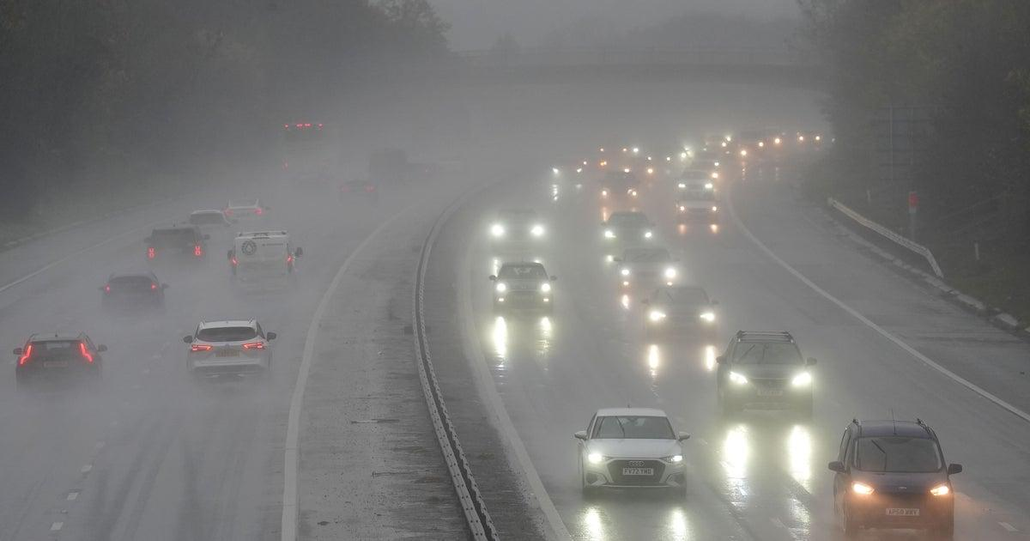
By combining rainfall data with local drainage information, historical incidents, and field inspections, road operators can better identify vulnerable sections and prioritize maintenance or monitoring activities during heavy rain.
Visibility, however, is a separate concern. Although heavy rain, fog, and spray can reduce drivers’ visibility, rainfall measurements cannot directly determine how far a driver can see. Where quantitative visibility monitoring is required, dedicated visibility sensors should be used alongside weather monitoring equipment.
Together, these measurements help road operators build a clearer understanding of weather-related risks and make more informed decisions about road safety.
Choosing the Right Weather Monitoring Solution for Road Safety
Understanding weather-related road hazards is only the first step. The next challenge is choosing a monitoring approach that provides the right information for the road conditions being managed.
Some roads may only require monitoring a specific parameter, such as road-surface temperature or wind speed. Others face multiple weather-related risks throughout the year, making a broader view of local environmental conditions more useful. The right solution depends on the location, the hazards involved, and how the collected data will be used.
Weather Stations vs. Traditional Road Monitoring Methods
Road operators use a range of methods to monitor road conditions, from manual inspections and weather forecasts to dedicated sensors. Each serves a purpose, but their coverage and capabilities differ.
| Monitoring Method | Main Advantages | Limitations |
| Manual Inspections | Directly observe road conditions and visible hazards | Periodic checks may miss rapidly changing conditions |
| Weather Forecasts | Help anticipate regional weather changes | May not reflect local conditions at specific road sections |
| Single-Parameter Sensors | Provide focused measurements, such as pavement temperature or visibility | Cover only specific parameters and risks |
| All-in-One Weather Stations | Collect multiple weather parameters at one location for a broader view of local conditions | Cannot replace specialized road-surface or visibility sensors when direct measurements are required |
An all-in-one weather station complements existing monitoring methods by bringing key weather measurements together. Temperature, humidity, rainfall, wind speed, and wind direction can help road operators assess changing environmental conditions and make better-informed decisions about inspections, maintenance, and safety measures.
For more comprehensive monitoring, weather stations can also work alongside road-surface sensors, visibility monitoring equipment, and traffic management systems.
Which Weather Parameters Matter Most for Road Safety?
Not every road requires the same monitoring setup. Selecting the right parameters starts with understanding the main risks at each location.
For road icing risk, air temperature and relative humidity provide important information about the surrounding conditions. Dew point can help assess moisture conditions, while rainfall and solar radiation provide additional context for understanding wet roads and surface cooling. Direct confirmation of ice formation may require road-surface temperature or road-condition sensors.
For asphalt heat stress, air temperature and solar radiation help describe the thermal environment around the road. Wind measurements provide further context for heat exchange. Where pavement temperature is critical, a dedicated road-surface temperature sensor can provide more direct information.
For crosswind monitoring, wind speed and wind direction are the primary parameters. Their relationship to road orientation helps operators understand potential lateral wind exposure, particularly on bridges, elevated highways, and open coastal routes.
For heavy rainfall, rainfall measurements help track precipitation and identify periods of increased concern for drainage and surface water accumulation. Temperature, humidity, wind, and atmospheric pressure can provide additional context for understanding changing weather conditions. If reduced visibility is a key concern, a dedicated visibility sensor is needed.
Atmospheric pressure can contribute to broader weather analysis, but it should not be treated as a standalone indicator of these road hazards.
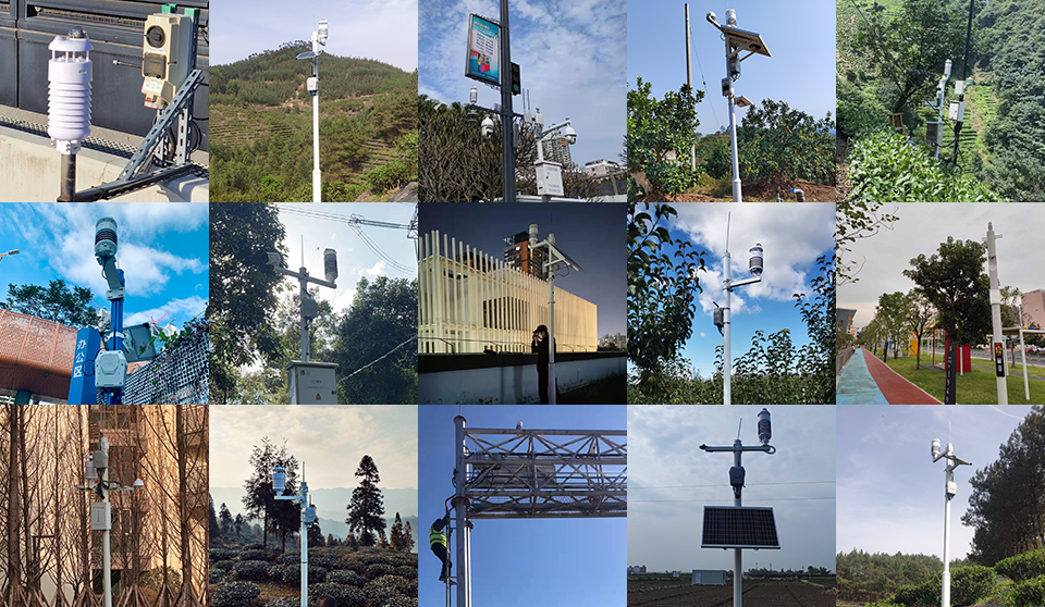
For road operators managing several types of weather risk, an all-in-one compact weather station can provide a practical starting point. By bringing multiple environmental measurements together, it helps establish a consistent local weather record and supports decisions about whether additional road-specific sensors are needed.
Ultimately, the best monitoring solution is not necessarily the one with the most sensors. It is the one that provides reliable, relevant data for the risks that matter most at each road location.
Building a Complete Road Weather and Environmental Monitoring Solution with SenseCAP
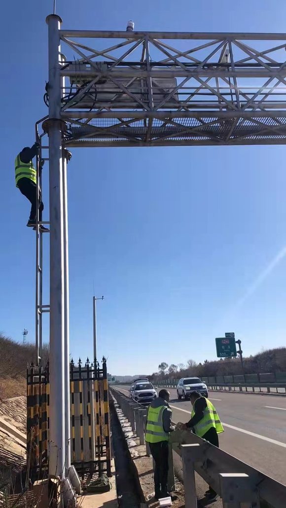
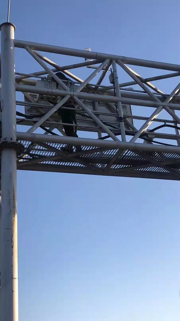
Road monitoring involves more than weather conditions. In addition to icing, extreme heat, crosswinds, and heavy rainfall, traffic-related air pollution and noise are important environmental concerns, particularly along busy highways and urban roads.
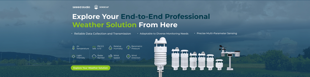
The SenseCAP Professional Weather Station Series offers a range of all-in-one sensors that measure different combinations of meteorological and environmental parameters. Combined with compatible data loggers and specialized sensors, they can support a flexible road monitoring solution.
Matching SenseCAP Weather Stations to Road Monitoring Applications
| Road Monitoring Application | Key Parameters | Recommended SenseCAP Products |
| Road icing risk | Air temperature, relative humidity, rainfall, solar radiation | SenseCAP S700-A, SenseCAP S700-C |
| Asphalt heat stress | Air temperature, solar radiation, wind speed | SenseCAP S700-B, SenseCAP S700-C |
| Crosswind hazards | Wind speed, wind direction | SenseCAP S200, SenseCAP S500, SenseCAP S700 |
| Heavy rainfall | Rainfall intensity, air temperature, relative humidity, wind speed | SenseCAP S700-A, SenseCAP S700-C, SenseCAP S1000 |
| Visibility-related risks | Rainfall, temperature, humidity, wind | SenseCAP S700-A, SenseCAP S1000 |
| Traffic-related air pollution | PM2.5, PM10, CO₂, wind speed, wind direction | SenseCAP S1000 |
| Road traffic noise | Noise level, wind speed, wind direction | SenseCAP S800 |
The recommended models offer different parameter combinations. For example, the S200 focuses on wind speed and direction, while the S700 series provides broader meteorological measurements. The S800 adds particulate matter and noise monitoring, and the S1000 combines weather measurements with PM2.5, PM10, and CO₂ monitoring. Select the model according to the parameters required at each site.
It is also important to distinguish between environmental indicators and direct hazard measurements. Weather stations can help identify conditions associated with icing or reduced visibility, but confirming road ice, measuring pavement temperature, or determining visibility distance requires the corresponding specialized sensors.
Choosing a Data Logger for Reliable Data Collection
After selecting the appropriate sensors, the next step is to transmit measurements to a monitoring platform. SenseCAP supports different data collection options depending on the deployment’s communication infrastructure.
| Data Logger | Communication Method | Suitable Deployment |
| SenseCAP Sensor Hub 4G Data Logger | Cellular 4G | Remote road sections where cellular coverage is available |
| SenseCAP S2100 LoRaWAN Data Logger | LoRaWAN through a compatible gateway | Road monitoring networks with existing or planned LoRaWAN coverage |
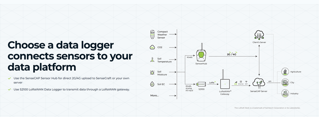
For compatible RS485 weather stations, the Sensor Hub provides a cellular data transmission option, while the S2100 enables LoRaWAN connectivity. The choice depends on sensor interfaces, power requirements, network coverage, and the existing monitoring infrastructure. Confirm compatibility with the selected model and configuration before deployment.
Integrating Weather and Environmental Data
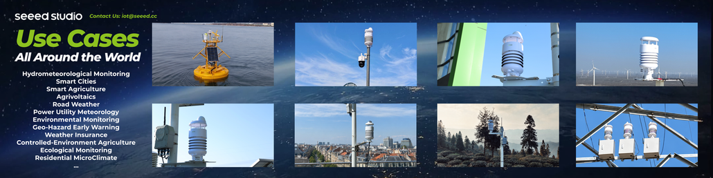
A complete monitoring system combines field measurements, data transmission, and a platform for visualization and analysis. SenseCAP data loggers can transmit compatible sensor data to SenseCraft or a customer-managed server, allowing operators to review current measurements, track historical trends, and integrate data into existing workflows.
By deploying different weather stations at strategic locations, road operators can monitor crosswinds on exposed bridges, weather conditions on icing-prone road sections, rainfall along flood-prone routes, and air quality near busy highways. Additional road-surface, visibility, or specialized gas sensors can be incorporated when direct measurements are needed.
This modular approach allows road authorities to build a monitoring network around their specific requirements, combining road safety and environmental monitoring in one integrated solution.
Turning Road Weather Data into Safer Roads
Safer roads start with better visibility into changing environmental conditions. From icy bridges and heat-exposed pavement to crosswind hazards, heavy rainfall, and traffic-related air pollution, reliable local data helps road operators understand risks and make more informed decisions.
With the SenseCAP range of all-in-one weather stations, environmental monitoring devices, and compatible data loggers, road authorities can build flexible monitoring solutions tailored to different road conditions and deployment needs. By combining weather data with specialized sensors where necessary, they can move beyond reactive inspections toward more proactive road maintenance and safety management.
If you have similar weather monitoring needs, contact us at[email protected]. Tell us about your project, and the Seeed team will put together a detailed solution for you.
Seeed Studio is helping lead this transition through the SenseCAP weather station portfolio. SenseCAP combines industrial-grade sensing, compact all-in-one hardware, open communication protocols, flexible data paths, and a repeatable deployment architecture.
Seeed Studio works with more than 200 partners and over 1,000 customers across 120+ countries, with SenseCAP deployments spanning greenhouse and vineyard monitoring, smart-city observation, renewable-energy sites, environmental research, and industrial facilities. This is the direction professional weather monitoring is taking, and SenseCAP is building the products and integration ecosystem needed to move it forward.
About Author
