Monitoring Mountain Disaster Risks in Nepal: How Weather Data Supports Early Warning
Introduction
In Nepal’s mountainous regions, natural hazards can develop rapidly, leaving communities and infrastructure with very little time to respond. Glacial and rock avalanches can trigger debris flows that travel down narrow valleys, potentially reaching downstream settlements and critical transport routes within minutes.
In such environments, effective risk management depends on more than regional weather forecasts or occasional field inspections. It requires continuous, site-specific monitoring to help identify changing environmental conditions and provide timely data for risk assessment.
This is where integrated environmental monitoring becomes essential. By combining weather observations with river-level measurements, soil moisture data, and visual monitoring, a connected monitoring system can help stakeholders better understand evolving conditions and support more informed early-warning decisions.
When Minutes Matter: The Challenge of Mountain Disaster Monitoring
The urgency of disaster monitoring in Nepal is clear from the risks facing its mountainous terrain. When an ice-rock avalanche occurs, the resulting debris flow can move rapidly through river channels, changing the conditions downstream with little warning. According to the project information, the time between an ice-rock avalanche and its impact at the Gyirong Port area could be as short as 6–7 minutes.
Such a narrow response window makes timely, reliable field data especially important. Regional forecasts may not capture rapidly changing conditions at a specific river section, while manual inspections cannot provide continuous coverage of remote and difficult-to-access locations. Monitoring only river levels may also leave gaps in understanding the environmental conditions surrounding a potential hazard.
A more comprehensive approach is therefore needed: one that continuously collects local environmental data and brings different monitoring sources together. Tracking rainfall and other weather conditions alongside river levels, soil moisture, and changes observed through visual monitoring can provide a more complete picture of the situation on the ground.
The goal is not to rely on a single sensor to predict a disaster, but to establish a monitoring system that helps detect changing conditions, supports risk assessment, and enables responsible teams to respond as quickly as possible.
Why Weather Data Matters for Debris-Flow Risk Monitoring
Nepal glacier collapses and flood – before and after
Understanding the Environmental Conditions
Weather conditions provide important context for understanding how environmental risks develop in mountainous regions. Rainfall, in particular, is a key parameter to monitor because it can influence soil moisture, surface runoff, and river conditions. Tracking rainfall alongside other environmental indicators helps build a more complete understanding of changes across a monitored area.
Combining Multiple Data Sources
Weather data alone cannot provide a complete picture of debris-flow risk. River-level measurements can help identify changes in water conditions, while soil moisture sensors provide information about moisture levels in the surrounding ground. Visual monitoring can offer additional insights into river conditions and visible changes in the environment.
By combining these data sources, the monitoring system can support a more comprehensive assessment of potential hazards. This is why the Nepal project integrates weather monitoring, river-level measurement, soil moisture sensing, and visual observation.
The Role of Weather Monitoring in Early Warning
Within this system, the SenseCAP S700-C weather station serves as the meteorological monitoring point, collecting rainfall and other weather parameters to complement data from the other sensors.
Through LoRaWAN connectivity, field devices can transmit monitoring data to a central platform for visualization and analysis. Based on validated thresholds and risk-assessment rules, the platform can help identify abnormal conditions and notify responsible personnel.
The goal is not to rely on a single sensor to predict a disaster, but to combine multiple data sources with a clearly defined alert and response process. This approach helps teams better understand changing conditions and make more informed decisions when potential risks emerge.
Why Choose Radar Weather Monitoring?
Reducing Mechanical Complexity in Rainfall Measurement
In remote mountainous areas, monitoring equipment may be difficult to access, making maintenance requirements an important consideration when selecting sensors. Traditional tipping-bucket rain gauges measure rainfall by collecting water and counting the movements of a mechanical bucket. While widely used, this mechanism involves moving parts that may require maintenance over time.
Radar rainfall measurement offers an alternative by detecting precipitation without relying on a mechanical tipping mechanism. By reducing dependence on moving parts, this approach can help minimize wear associated with mechanical operation and reduce certain maintenance requirements, an important consideration for monitoring stations deployed in remote locations.
Integrating Multiple Weather Parameters
Rainfall is only one part of the environmental picture. Wind speed, wind direction, temperature, and other meteorological parameters can provide additional context for understanding local conditions.
An integrated weather station such as the SenseCAP S700-C brings multiple weather measurements together in a single device. This simplifies deployment compared with installing and maintaining several independent instruments, while providing complementary meteorological data for analysis alongside river-level and soil moisture measurements.
Designed Around Real-World Deployment Conditions
Choosing a weather station for a mountainous monitoring project involves more than measurement technology alone. Installation location, operating temperature, power availability, communication coverage, and the accessibility of the site all need to be considered.
For example, solar-powered deployments require careful assessment of local sunlight conditions and the system’s overall power consumption. LoRaWAN coverage and gateway connectivity also need to be verified at the intended installation points to help ensure that field data can reach the monitoring platform reliably.
In a debris-flow monitoring system, the value of radar weather monitoring lies not only in how rainfall is measured, but also in how the weather station fits into the wider monitoring infrastructure. The SenseCAP S700-C provides a compact source of meteorological data that can complement other field measurements and support a more integrated approach to environmental risk monitoring.
Real-World Application: Building a Mountain Disaster Monitoring Network with SenseCAP
In Nepal’s mountainous regions, the challenge of debris-flow monitoring extends beyond detecting an initial event. Ice and rock collapses can trigger debris flows that travel downstream, potentially block river channels, accumulate water, and cause sudden secondary releases. When the distance between the source area and downstream communities is significant, continuous field monitoring and reliable communication become essential for risk assessment and emergency response.
To address these challenges, the proposed monitoring system combines LoRaWAN environmental monitoring with AI river observation and Meshtastic off-grid communication. Seeed Studio’s SenseCAP devices provide the foundation for collecting and transmitting field data, while the monitoring platform and local response procedures connect detected anomalies to practical action.
1. Monitoring River Conditions and Local Weather
The first layer focuses on collecting environmental data at selected river sections, potential blockage areas, and downstream locations requiring protection. The proposed deployment combines water-level sensors, soil moisture sensors, visual AI monitoring, and a dedicated weather station.
A. SenseCAP S700-C weather station
The SenseCAP S700-C 7-in-1 Compact Weather Station provides localized meteorological measurements, including rainfall and other weather parameters. By recording rainfall alongside river-level and soil moisture measurements, it helps operators understand the environmental conditions surrounding changes in river behavior.
The station is intended to provide weather context for risk assessment, rather than independently predict debris flows. Its measurements can be compared with water-level trends and other observations to support predefined monitoring and alert rules.
B. Soil moisture monitoring
The SenseCAP S2108 Soil Moisture, Temperature and Pore EC Sensor measures soil moisture, temperature, and pore electrical conductivity. Deployed at selected riverbank or slope locations, it provides additional information about changes in ground moisture conditions.
These measurements can complement rainfall data when assessing local environmental changes, although soil moisture alone cannot establish whether a slope is about to fail.
C. River water-level monitoring
The proposed system includes two types of water-level measurement equipment, selected according to local installation conditions:
- The RS485 750cm Ultrasonic Level Sensor measures the distance to a water surface without requiring the sensing element to be submerged. Its suitability depends on the available mounting position, measurement geometry, and river conditions.
- The Industrial Liquid Level Sensor MODBUS RS485 is a submerged pressure-based sensor for measuring liquid level. The listed industrial sensor supports a measurement range of 0–5 m and RS485 Modbus-RTU output.
Using suitable sensors at multiple river sections can help operators compare water-level changes along the river and identify unusual rises that require further investigation.
D. AI-assisted river observation
The SenseCAP A1102 LoRaWAN Vision AI Sensor adds visual sensing and edge AI capabilities to the monitoring network. Installed at suitable locations, it can run supported AI models to identify configured visual conditions and transmit detection results over LoRaWAN.
Together, these monitoring devices provide complementary information about rainfall, ground moisture, river levels, and visible changes. Their combined measurements create a more useful basis for assessing unusual conditions than any single sensor can provide.
2. Connecting Field Sensors Through LoRaWAN
Collecting data in remote mountain locations is only the first step. The measurements must also reach a central platform where operators can review trends, check device status, and respond to alerts.
The proposed system uses the following components to establish its data collection and transmission chain.
A. SenseCAP S2100 LoRaWAN Data Logger
The SenseCAP S2100 LoRaWAN Data Logger connects compatible external sensors through RS485, analog, or GPIO interfaces and transmits their measurements over LoRaWAN.
In this project, S2100 units are intended to connect supported wired sensors, including RS485 water-level probes, to the wireless network. The exact number of loggers and their allocation should be finalized according to the selected sensors, interface requirements, and field wiring plan.
B. S2100 Waterproof Junction Box Kit
The S2100 Waterproof Junction Box Kit provides an IP68-rated connection enclosure for integrating the S2100 with an external 12 V power supply. It helps protect the power and connection interfaces in outdoor installations and simplifies field wiring.
C. SenseCAP Outdoor Gateway
The SenseCAP Outdoor Gateway – LoRaWAN EU868MHz receives LoRaWAN messages from compatible field devices and forwards them to the network server through an available backhaul connection.
Multiple gateways can be deployed at suitable locations to provide coverage for distributed monitoring points. However, actual coverage depends on terrain, antenna placement, obstructions, radio conditions, and the selected gateway backhaul. A field survey is therefore necessary to verify connectivity across the intended deployment area.
Power-system design must account for local sunlight, battery capacity, seasonal conditions, and the power consumption of each connected device. In particular, the 12 W panel should not be assumed to provide sufficient power for the weather station’s sensor-heating function under all conditions. The final power arrangement should be verified against the operating requirements of the complete system.
The data flow can be summarized as:
Field sensors → SenseCAP S2100 data acquisition → LoRaWAN gateway → Network server and monitoring platform → Configured alerts and response procedures
The platform can display water-level trends, weather measurements, sensor readings, device connectivity, and event records. These functions help operators review changing conditions and investigate potential anomalies.
3. From Sensor Alerts to Emergency Coordination
Environmental monitoring is only effective when detected anomalies lead to a clear response. The proposed system therefore includes two complementary mechanisms: platform-based alerts and off-grid communication for field personnel.
Platform-based alert handling
The monitoring platform applies thresholds or other rules validated for the selected sensors and locations. When a configured condition is met, it notifies designated personnel, who can acknowledge the alert, assess the available data, and initiate the relevant inspection or response procedure.
For example, a rapid rise in river level combined with heavy rainfall may trigger further investigation. The system should record whether the notification was delivered, whether the responsible person acknowledged it, and what action followed. Escalation procedures are also needed if an alert remains unacknowledged.
Thresholds must be determined and validated for local river conditions. Sensor readings should be treated as inputs to risk assessment, not as standalone confirmation of an imminent disaster.
Mesh communication for field teams
If mobile networks or conventional communication infrastructure become unavailable, field personnel may need an independent means of exchanging messages and sharing their locations.
The Wio Tracker L1 Pro is a portable Mesh device with LoRa communication, GNSS positioning, a display, and a rechargeable battery. It can support text messaging and location sharing between participating devices within a configured Mesh network.
The SenseCAP Solar Node P1-Pro for Meshtastic is a solar-powered fixed communication node with integrated positioning and a battery. It can serve as part of the communication infrastructure to extend network connectivity along selected inspection routes, subject to radio coverage and terrain.
Meshtastic operates independently of the LoRaWAN monitoring data path. It supports field communication and coordination but does not automatically replace the platform’s alerting mechanism. If an environmental alert needs to reach a field team through Meshtastic, the information must be relayed through an appropriate, defined workflow.
Integrating Monitoring, Alerts, and Response
The overall solution combines environmental sensing, wireless data transmission, platform-based monitoring, and independent field communication.
Weather data from the S700-C helps establish the local meteorological context. Water-level and soil moisture sensors track changes in river and ground conditions, while the A1102 provides visual AI sensing at suitable monitoring points. S2100 data loggers and LoRaWAN gateways carry compatible sensor measurements to the platform, where configured rules support anomaly detection and notification.
At the same time, Wio Tracker L1 Pro devices and fixed Meshtastic nodes provide a separate communication channel for field teams when conventional connectivity is unavailable.
The key value of this architecture is the connection between monitoring, information delivery, and human response. Reliable early warning depends not only on sensors and connectivity, but also on validated detection methods, suitable deployment locations, clear responsibilities, and rehearsed emergency procedures.
If you have similar weather monitoring needs, contact us at [email protected]. Tell us about your project, and the Seeed team will put together a detailed solution for you.
Seeed Studio is helping lead this transition through the SenseCAP weather station portfolio. SenseCAP combines industrial-grade sensing, compact all-in-one hardware, open communication protocols, flexible data paths, and a repeatable deployment architecture.
Seeed Studio works with more than 200 partners and over 1,000 customers across 120+ countries, with SenseCAP deployments spanning greenhouse and vineyard monitoring, smart-city observation, renewable-energy sites, environmental research, and industrial facilities. This is the direction professional weather monitoring is taking, and SenseCAP is building the products and integration ecosystem needed to move it forward.
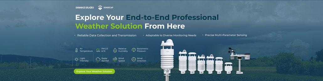
Related Articles on Radar Rainfall Measurement
Want to learn more about radar rainfall measurement, weather stations, and their applications? Explore these related articles from Seeed:
- Doppler Radar Precipitation Sensor: How Can It Measure Rain Without a Funnel?
- Radar Compact Weather Station: SenseCAP S700-C for IoT Weather Monitoring
- Agricultural Weather Station Guide: What to Measure and How to Choose
- Seeed Studio at Meteorological Technology World Expo 2026
- Best 7-in-1 Weather Stations: Features, Applications, and Selection Guide
About Author
