Stopping Wildfires Before They Start: Why Weather Sensors Are the Sensory Nerves of Forest Fire Early Warning
Forest fire danger is decided by weather before it is decided by fire. Learn how fuel moisture, rain-free days, and wind data power early warning—and why integrated sensors like the SenseCAP ONE S700 belong in the field.
Forest fire danger is decided by weather before it is decided by fire: fuel moisture, rain-free days, and wind determine where a fire will start and how fast it will spread [6][7][11]. Here is how forest fire danger monitoring stations turn these micro-meteorological signals into early warnings—and why integrated, maintenance-free weather sensors such as the SenseCAP S700 7-in-1 are the practical backbone of mountain deployments [13].
Published by Seeed Studio SenseCAP Team
Published on 3 November 2026 · Lasted Update 3 November 2026
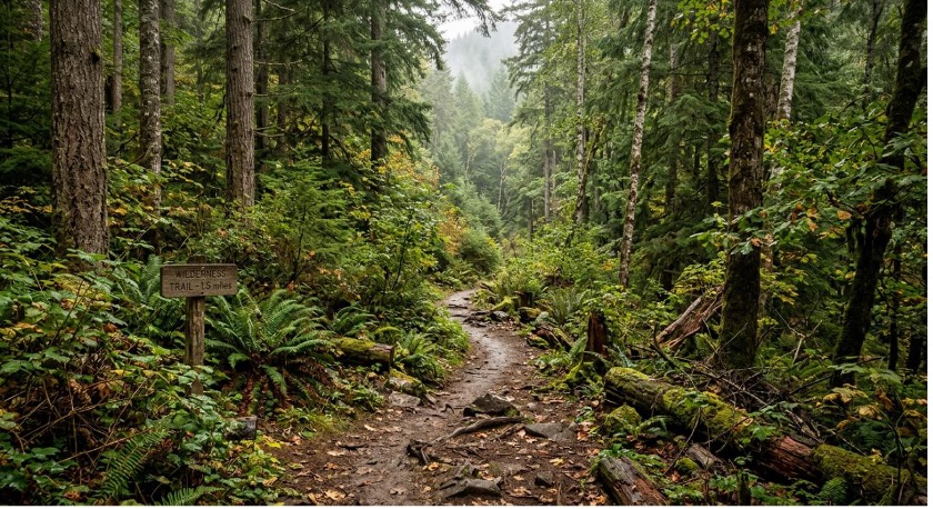
(Forests are never short of fuel—weather decides when that fuel will burn.)
What Is a Forest Fire Danger Rating?
Put simply, forest fire danger rating is a numerical assessment of how likely a wildfire is to start—and how fast it is likely to spread—given current and forecast weather. In China, 2023 recorded 328 forest fires affecting 4,134 hectares; although the number sits at a historic low, those fires still claimed two lives [4][5]. The longer trend points the same way: average annual forest fires fell from about 16,000 in 1950–1989 to about 6,000 in 1990–2020 and below 1,000 since 2021 [2].
Human activity remains the dominant cause—90% or more of China’s forest and grassland fires are human-caused, and 97% of investigated fires during 2010–2019 were traced to human ignition [1][2]. Around 70% occur in the forest belts of the northeast and southwest [3]. The most widely used rating framework is the Canadian Fire Weather Index (FWI) System, used extensively in Canada and internationally. It combines six components—three fuel-moisture codes and three fire-behavior indices—computed from noon temperature, relative humidity, wind speed, and 24-hour precipitation [7]. A station that feeds such a system must therefore track exactly these variables: temperature, humidity, rainfall, and wind.
Before a Fire Breaks Out: Meteorological Data Provide the Physical Basis for Assessing Fuel Flammability
Every wildfire depends on the fire triangle—fuel, heat, and oxygen [6]. In a forest, fuel is never scarce: leaf litter, needles, twigs, and understory plants are always present. What decides whether that fuel will ignite is weather. Whether surface fuels are easy to light is governed by how dry they are—and dryness is governed by temperature, humidity, and precipitation.
Air Humidity and Temperature: The Driver of Fuel Moisture Content
When relative humidity stays low for days, moisture evaporates from leaf litter and branches, and fine fuels move toward their ignition point. Fire scientists quantify this with the Fine Fuel Moisture Code (FFMC)—a numeric rating of litter and other fine-fuel dryness, scaled 0–101, where higher values mean easier ignition [8]. A persistent low-humidity spell can shift a forest from “safe” to “ready to burn.”
A station that logs temperature and humidity 24/7 gives fire managers the inputs the FFMC needs. The SenseCAP S700 7-in-1 measures air temperature from −40 to +85 °C with ±0.1 °C accuracy and relative humidity with ±1.5 %RH accuracy [13][14]—numbers that keep the fuel-moisture calculation trustworthy through day–night swings and mountain fog.
Precipitation and Rain-Free Days: Building Cumulative Fire Risk
Rainfall raises humidity directly, but more importantly, the amount of rain determines how quickly soil and vegetation regain moisture. The FWI System tracks this drying at different depths: the Duff Moisture Code (DMC) follows the loosely compacted organic layer 5–10 cm below the litter, and the Drought Code (DC) tracks deeper, compact organic layers [7]. Consecutive rain-free days and cumulative precipitation recorded by a sensor are therefore core inputs for these codes—cumulative dryness, not today’s weather alone, sets the stage for a fire.
Video vs. sensors: from reactive alarm to proactive warning
A side-by-side comparison: video surveillance can raise the alarm only after smoke or flames have already appeared. Meteorological sensors assess the probability of ignition before it happens—they measure the conditions that make a fire possible. With more than 90% of fires human-caused, prevention is largely a people problem; the part of prevention that can run unattended, 24/7, is weather monitoring [2].
When a Fire Occurs: Wind Data Are the Key to Predicting How a Fire Will Spread
Once a fire breaks out, wind speed and direction in the forest microclimate directly drive how it evolves—and can trigger catastrophic blowups, defined in the NWCG Glossary of Wildland Fire as a sudden increase in fireline intensity or rate of spread sufficient to preclude direct control [10].
Wind speed drives spread rate
Wind speed and direction have long been recognized as key drivers of fire spread rates in fire-behavior science (Byram 1958; Rothermel 1972) [11]. Empirical studies across Australia, Canada, and the United States show spread rate increasing approximately exponentially as wind speed rises [12].
Wind direction determines the fire front and its spread
In mountainous terrain, valley winds and strong local gusts are common. A sudden shift in wind direction can send the fire front veering, endangering crews on the ground [10]. This is why high-frequency wind data matter as much as speed: the same slope can go from safe to dangerous in minutes.
Mechanical cup anemometers are prone to jamming and wear from wind-blown debris in the field, which is why modern stations use ultrasonic sensors with no moving parts. The SenseCAP S700 measures wind speed across 0–60 m/s (withstanding up to 80 m/s) with ±0.3 m/s accuracy below 10 m/s, and wind direction across 0–360° with ±3° accuracy, feeding the command platform in real time [13][14].
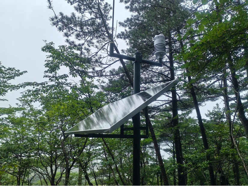
(One station, seven measurements: air temperature, relative humidity, wind speed, wind direction, barometric pressure, rainfall)
Severe Field Environments: Why Highly Integrated, Maintenance-Free Equipment Matters
Forest fire danger monitoring stations are typically deployed on high-altitude, fog-prone, humid, or remote sites deep in forest areas. At these sites, the form factor of the chosen weather sensor directly affects the station’s long-term reliability.
Multi-parameter integrated design
Tower masts at field sites offer limited space and power. The SenseCAP S700 7-in-1 integrates seven measurements—air temperature, relative humidity, barometric pressure, wind speed, wind direction, rainfall intensity, and light intensity—in a single, compact unit, avoiding the wiring and installation complexity of deploying multiple separate sensors [13].
High protection, low power
Mountain environments are prone to heavy fog and extreme humidity. The S700 offers an IP66 dust- and water-resistance rating and operates from −40 to +85 °C, with RS-485 (Modbus-RTU) and SDI-12 field buses for direct connection to data loggers and monitoring platforms—so the equipment keeps transmitting reliably in unattended, extreme conditions [13][14].
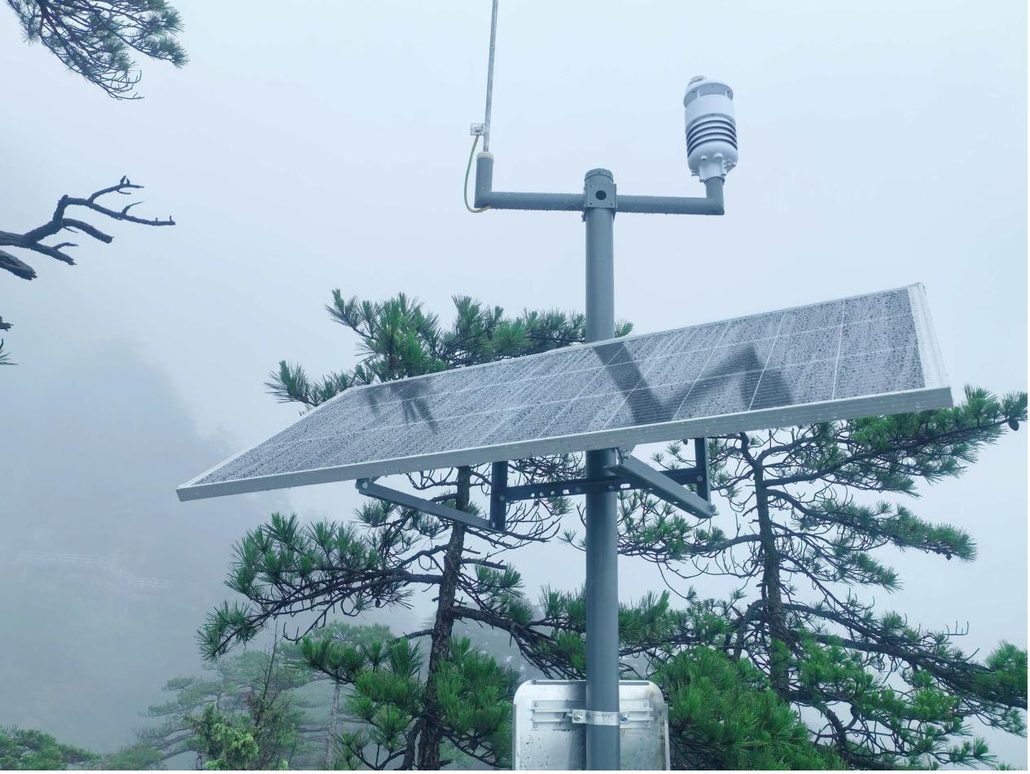
(Fog, frost, and altitude: field weather stations must keep measuring…)
Value in Practice
Inside forest fire danger monitoring stations, weather sensors are far more than optional add-ons—they are the sensory nerves of wildfire early-warning models.
- Before a fire breaks out: temperature, humidity, precipitation, and barometric pressure data feed fire-danger assessment, enabling early warning before a fire ignites [7].
- After a fire breaks out: high-frequency wind speed and direction data guide fire-behavior analysis and firefighting response [10][11].
As field deployments of the SenseCAP S700 7-in-1 in mountainous forests demonstrate, modern, highly integrated, maintenance-free weather sensors are the technical foundation for accurate early warning before a fire, and data-driven decisions during one [13].
Key Takeaways on Forest Fire Weather Monitoring
- Wildfire risk is weather before it is fire: fuel moisture and wind are the leading indicators, not smoke [6][11].
- Standardized codes such as the FWI System’s FFMC and ISI turn raw sensor data into decision-ready ratings for ignition and spread [7][9].
- Integrated, maintenance-free stations such as the SenseCAP S700 (IP66, −40–85 °C, RS-485/SDI-12) make round-the-clock mountain monitoring practical [13][14].
Frequently Asked Questions
Q1: Can’t video surveillance and satellites replace weather sensors for wildfire early warning?
They answer different questions. Cameras and satellites detect fires that are already burning; weather sensors measure the conditions that determine whether a fire starts and how it spreads. With more than 90% of China’s forest and grassland fires human-caused, the gap weather monitoring fills is prevention, not suppression [2]. Lightning-caused fires are also on the rise: in 2024 they accounted for 113 fires, or 38.7% of the national total—and those fires still depend on dry fuels and storms, conditions a weather station records in advance [2].
Q2: Which weather parameters matter most for forest fire risk?
The four that drive the FWI System: air temperature, relative humidity, wind speed, and 24-hour precipitation [7]. From these, the system derives fuel-moisture codes (FFMC, DMC, DC) that rate how dry the forest floor is, and fire-behavior indices (ISI, BUI, FWI) that rate spread potential [7][8].
Q3: What is the Fire Weather Index (FWI) and how does it work?
The FWI System is a Canadian framework used extensively in Canada and internationally [7]. It combines six components—three fuel-moisture codes and three fire-behavior indices—computed from local noon temperature, humidity, wind speed, and 24-hour precipitation, producing a single numeric rating of fire danger [7][8].
Q4: What should a forest fire weather station measure, and which specs matter in the field?
Measure the seven parameters that cover fuel moisture and wind: air temperature, relative humidity, barometric pressure, wind speed, wind direction, rainfall intensity, and light intensity [13]. For mountain deployment, prioritize an IP66 rating, a wide operating temperature range (−40 to +85 °C), ultrasonic wind sensing with no moving parts, and standard field buses such as RS-485 Modbus-RTU and SDI-12—all found in the SenseCAP S700 7-in-1 [13][14].
Sources & References
- [1] Ministry of Emergency Management, PRC — Most forest fires in China are caused by human activity (97%+ of investigated fires, 2010–2019) — https://www.mem.gov.cn/xw/mtxx/202004/t20200409_349694.shtml
- [2] Ministry of Emergency Management, PRC (press conference, 2025-03-21) — Human causes account for 90%+; annual fire trends; 2024 lightning-caused fires: 113, or 38.7% — https://www.mem.gov.cn/xw/xwfbh/2025n03y21xwfbh/
- [3] Ministry of Emergency Management, PRC — Northeast and southwest forest belts account for 70%+ of China’s forest fires — https://www.mem.gov.cn/xw/mtxx/202203/t20220316_409708.shtml
- [4] National Forestry and Grassland Administration — 2023 national forest fires: 328 cases, 4,134.06 ha affected — https://www.forestry.gov.cn/c/www/zyxx/542993.jhtml
- [5] The State Council / Ministry of Emergency Management — 2023 basic situation of national disasters (328 forest fires, 2 deaths, −77.5% vs. five-year average) — https://www.gov.cn/lianbo/bumen/202401/content_6927328.htm
- [6] FAO — Forest Fire Behaviour (fire triangle: fuel, heat, oxygen) — https://openknowledge.fao.org/server/api/core/bitstreams/fbb1b277-7c74-4bf1-8b6a-24d49afcfb5d/content/i1363e06.pdf
- [7] Canadian Wildland Fire Information System (CWFIS) — Fire Weather Index (FWI) System: six components (FFMC/DMC/DC + ISI/BUI/FWI) — https://cwfis.cfs.nrcan.gc.ca/en/faq
- [8] Province of British Columbia — Fire Weather Index System (FFMC: 0–101, fine-fuel dryness / ease of ignition) — https://www2.gov.bc.ca/gov/content/safety/wildfire-status/prepare/predictive-services/weather-fire-danger/fire-weather/fire-weather-index-system
- [9] Province of Nova Scotia — Fire Weather Forecast (ISI: wind + FFMC combined, predicting rate of spread) — https://novascotia.ca/natr/forestprotection/wildfire/forecasts.asp
- [10] NWCG — Glossary of Wildland Fire, PMS 205 (definition of blowup) — https://www.nwcg.gov/publications/pms205
- [11] PMC — What Are the Limits to the Growth of Boreal Fires? (citing Byram 1958; Rothermel 1972: wind speed and direction as key drivers of spread) — https://pmc.ncbi.nlm.nih.gov/articles/PMC11915198/
- [12] EUMeTrain — Forest Fires (studies from Australia, Canada, and the US: spread rate rises approximately exponentially with wind speed) — https://resources.eumetrain.org/data/3/30/print_3.htm
- [13] Seeed Studio Wiki — SenseCAP Series (S700 7-in-1: seven parameters, IP66, ultrasonic wind sensing with no moving parts, RS-485/SDI-12, −40 to +85 °C) — https://wiki.seeedstudio.com/Sensor/SenseCAP/SenseCAP_ONE_Weather_Station/SenseCAP-One-Series-Meteorological-Sensors/
- [14] Seeed Studio — SenseCAP Weather Sensor Catalogue (wind speed 0–60 m/s, withstands 80 m/s, ±0.3 m/s ≤10 m/s; wind direction 0–360° ±3°; temperature ±0.1 °C; humidity ±1.5 %RH; pressure 300–1250 hPa ±50 Pa) — https://files.seeedstudio.com/wiki/SenseCAP/LoRaWAN_Device_PDF/SenseCAP-Sensor-Probes.pdf
Read More from the Sensor Know-How Series
This article is part of the Weather Sensor Know-How series: practical guides to the technologies behind weather and environmental monitoring—from wind sensing and solar radiation to forest fire early warning.
If you have similar weather monitoring needs, contact us at [email protected]—and tell us which sensor topics you’d like us to demystify next. We love learning what you want to know more about.
- Two Technologies for Wind Monitoring: Cup-and-Vane vs. Ultrasonic Sensors
- Solar Radiation Sensors Explained: Thermopile vs. Photodiode
- Why Temperature Sensors Need a Solar Radiation Shield for Accurate Measurements
- NDIR CO2 Sensor Explained: How Infrared Gas Sensing Works
- Doppler Radar Precipitation Sensor: How Can It Measure Rain Without a Funnel?
- 2026 Climate Reality Check: When Extremes Become the Norm, How Do We Adapt?
- Giving Soil a “CT Scan”: Soil Moisture Sensors Explained
- From Experience to Evidence: How Growers in Ningxia Use SenseCAP Sensors to Help Prevent Cherry Tomato Cracking
About Author
